VUEDENHAUT_TERRILLEDOUX@OTCVM.jpgConde_Terril_ledoux
©Le Terril Ledoux at Condé-sur-l'Escaut|©Dboukla

The Chaine des Terrils in northern France

A listed site since 2016, the Chaîne des Terrils contributes to the reputation of French landscapes.

This classification follows the inclusion of mining landscapes as an “evolving cultural landscape” on the Unesco World Heritage List in 2012. It testifies to the recent change of perspective on an original landscape, entirely shaped by man.

The 78 slag heaps that make up the Chaîne des terrils are extremely diverse in terms of form, use, vegetation and management. Some are closed to the public, others are places for leisure, discovery and walking, sometimes even for nationally renowned sporting events. Finally, some are wonderful vantage points from which to discover the richness of the mining landscapes and to see the chain as a whole.

Enjoy your discovery!

Chaine Des Terrils Chaine Des Terrils
©Chaine Des Terrils

The slag heaps in a few words

Erected from millions of tons of shale extracted from deep underground, the slag heaps are the most striking symbols of the impact coal mining has had on the region. Once considered slag heaps, they have gradually become icons for the region. They are both markers of the landscape and spaces for new biodiversity and new uses.

The Nord-Pas-de-Calais coalfield has 339 listed slag heaps. Houillères du Bassin Nord-Pas-de-Calais has assigned a number to each slag heap in order to reference and exploit them. Many of these heaps have been mined, but only a few have disappeared.

Terrils are used for coal mining. Coal mining in the Basin Minier dates back to 1720.
Originally, the slag heap was a pile of sterile rock and waste. Flat slag heaps are the oldest, because in those days coal was transported by horse, so the slope couldn’t be too steep.

Some sites are conical or mixed heaps. Following closures, all slag heaps had to be razed to remove all traces of mining. However, in 1988, the “Chaine des terrils” association was set up to preserve the heaps. In agreement with some thirty local authorities, some of the slag heaps have been redeveloped as leisure and walking areas, or protected nature reserves.

A chain with a thousand facets

On each slag heap, walkers can encounter a variety of environments offering a change of scenery from a landscape of desert dunes to a completely wooded slag heap!

The slag heaps are renewed and become places for sporting, cultural, educational and tourist activities, enabling visitors to discover these exceptional places through new experiences. Visitors are asked not to leave the marked paths and to respect the posted regulations to help preserve this rich yet fragile heritage.

Did you know?

The chain of slag heaps, the visible manifestation of an underground coal seam, is around 100 km long and covers an area of around 1,832 hectares. Its size and state of preservation make it unique in Europe.

Everything, everything, everything... Everything you need to know about slag heaps 

A historic site

The chain of slag heaps is one of the strongest symbols of the identity of the Mining Basin. It bears witness to 270 years of coal mining, and is a reminder of the presence of underground coal seams. Dating from the Carboniferous period, these seams extend over 120km from Fresnes-sur-Escaut on the Belgian border (the cradle of mining in northern France), to Enquin-lez-Guinegatte at the gateway to the Boulonnais region.

It is also a representative sample of the 220 or so slag heaps (out of the 285 originally erected) that still dot the landscape, many of them in a state close to their original form.

Preserved thanks to the joint efforts of civil society, elected representatives and the CPIE Chaîne des terrils, they have become an important part of our collective memory, testifying to the magnitude of the efforts made by generations of men and women, both on the ground and on the surface. They also bear witness to the different slag heap construction techniques used, which can be grouped into 5 “generations” that are still visible.

A picturesque site

These slag heaps, reinvested by local residents and stakeholders, have benefited from a change of perspective in recent history. Initially regarded as “geological waste”, some spoil heaps were soon exploited, either wholly or in part, for their market value. Others, from the 1970s onwards, were redeveloped to manage mining risks, to mask their presence in the landscape through major planting operations, but also to offer residents new leisure and nature areas atypical of the region. They have also become home to a rich biodiversity specific to the area.

Whether untouched or sculpted, these varied, color-changing silhouettes stand out in an area of very low relief, made up of a mosaic of sixteen major landscapes.

The slag heaps attract attention in different ways, depending on whether they are set in an open landscape (such as agricultural plains), or in a closed context (urban or wooded).

Together, they form a chain that can be seen from outside the Bassin Minier, but also from the tops of the slag heaps themselves or from certain locations in the heart of the Bassin Minier.

Moreover, from their summits, they offer privileged vantage points for interpreting the richness and diversity of the landscapes (urban, agricultural, wooded, wetland) in which the mining industry was so rapidly established.

A reasoned ranking

The classification, supported by the Direction Régionale de l’Environnement de l’Aménagement et du logement Haut-de-France (DREAL), was intended to accompany the inclusion, in 2012, of the Mining Basin on the World Heritage List as a “living evolving cultural landscape”.

The majority of the 51 slagheaps included within the perimeter of the World Heritage Mining Basin have been included in this listed site.

The reasons for this listing are:

  1. The historical criterion: the site is associated with socio-economic activities that have contributed to the creation of landscapes representative of the history or image of a region.
  2. The picturesque criterion: a picturesque site is a landscape or place that attracts attention because of its original and aesthetic character.

Generations of slag heaps

The classification into “generations” is a simplified representation that helps to understand the formation of slag heaps, even if some are the result of a succession of techniques.

FIRST GENERATION SPOIL HEAPS

9 1st generation spoil heaps are classified.

At the start of mining in 1720, miners left waste rock in the galleries. From the 1800s onwards, advances in mining techniques enabled more material to be brought up and sorted on the surface. The first slag heaps appeared, in the form of small tabular heaps 10-30 m high, with gentle slopes. They were built by human and animal power (baskets, towed wagons) close to the pits, and many have now disappeared (mined out or covered by more recent slag heaps).

SECOND-GENERATION SPOIL HEAPS

20 2nd generation spoil heaps are classified.

They appeared at the end of the 19th century. Their conical shape enabled them to store more material while limiting the consumption of agricultural land. They were erected mechanically, by railcars pulled by a winch along a loading ramp (rails). Medium-sized, they do not exceed 65 m in height.

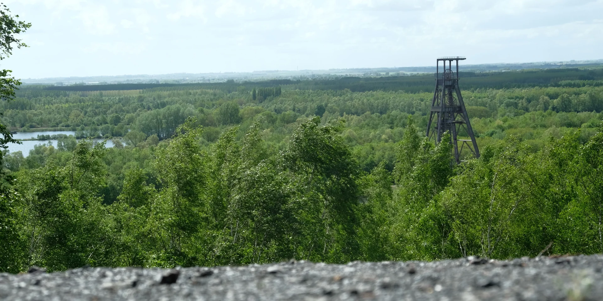
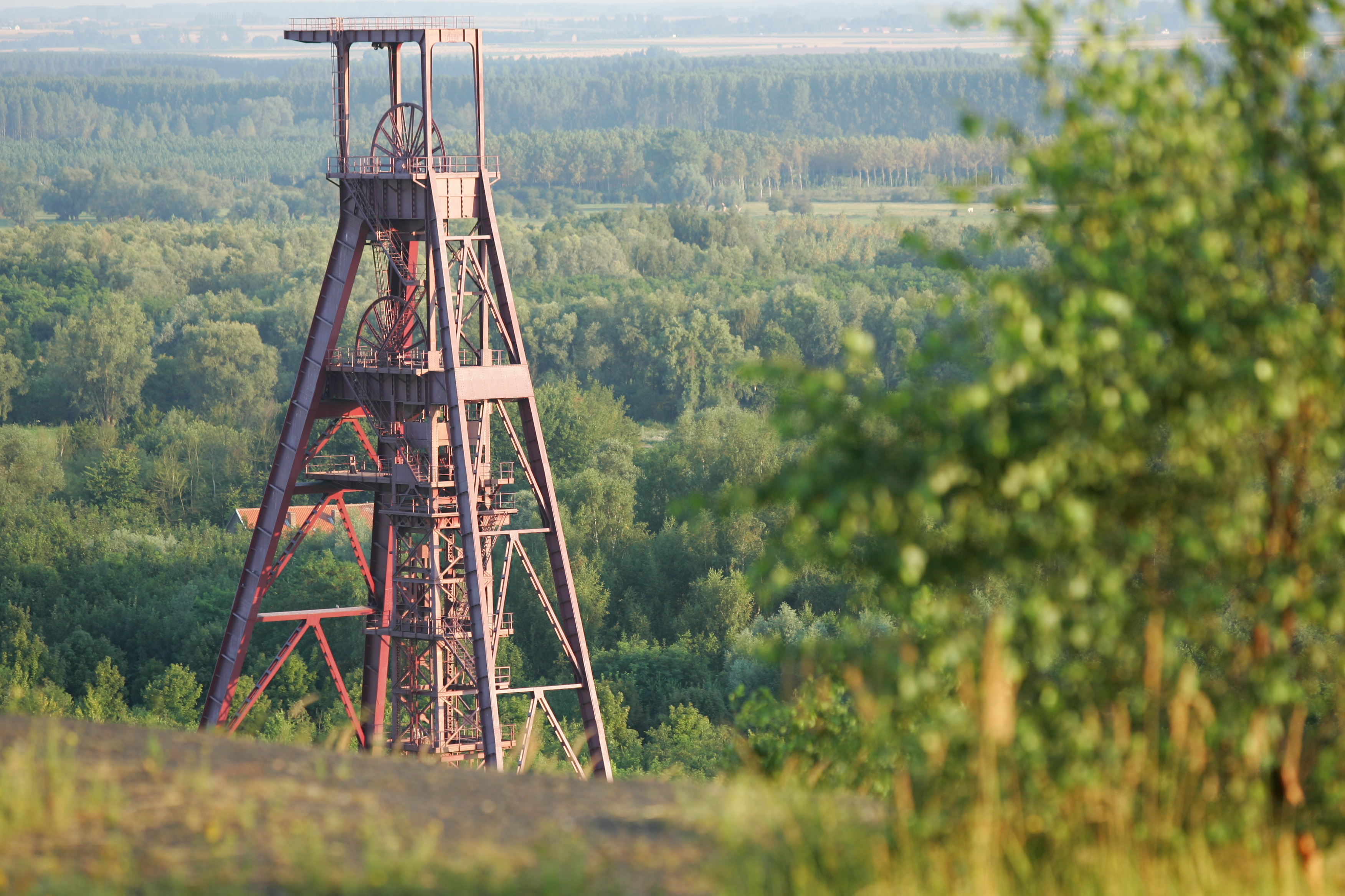
THIRD-GENERATION TIPS

15 3rd generation spoil heaps are classified.

They appeared at the end of the 20th century. At that time, the construction of conical tips using loading ramps remained widespread, but the use of cable cars as conveyors was introduced at the same time. Material was dropped between two pylons, forming a succession of large conical spoil heaps that gradually merged. The cableway was gradually abandoned, as its operation could not keep pace with post-World War II mining.

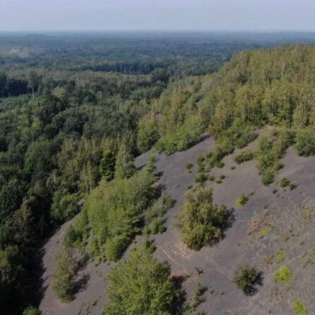
FOURTH-GENERATION TIPS

18 4th generation tips are listed.

They appeared with nationalization (1946), in the context of the post-war period and the intensification of coal mining. The concentration sites produced large modern slag heaps. The new construction system, which uses skips pulled along a ramp on rails, has created voluminous conical heaps. The skips dumped their contents at the top of the slag heap, on the opposite slope, or into mobile metal chutes that spread the material over the slopes, creating spiky micro-reliefs. When the desired height was reached, the slag heap was widened in successive arcs, following the movement of the conveyor.

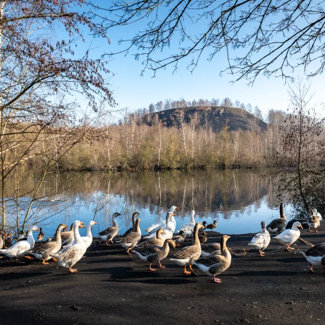
FIFTH-GENERATION HEAPS

16 5th-generation slag heaps are classified.

Built in parallel with generations 3 and 4, they are often extensive and tabular in shape. They were generally built on uncultivated farmland, such as valleys and wetlands, which were too soft to support the load of conical slag heaps (threat of subsidence and landslides). These spoil heaps were built using conveyor belts or railway conveyors with locomotives pulling hoppers. As the slag heaps progressed by moving the rails, this construction left a fan-shaped imprint on the plateau, rather like the striations on a scallop shell.

More must-sees

[TODO] Configuring highlighting to bring up pages of the Unmissable type